The workshop of DARIAH-PL Digital Philology Working Group “Mapping historical datasets – a place for everything and everything in its place?” took place on November 18, 2015 at the Institute of Literary Research of the Polish Academy of Sciences (IBL PAN). The Workshop was coorganised by Digital Humanities Centre at IBL PAN and Digital Humanities Lab, University of Warsaw (Laboratorium Cyfrowe Humanistyki UW). It was the first official DARIAH-PL event since consortium formally joined DARIAH-ERIC on November 6.
The workshop explored some of the tools, techniques and issues of mapping historical datasets. It focused in particular on data preparation, geolocation and visualization of data using freely available technologies. The workshop was attended by representatives of many facutlies and institutes from all over Poland.
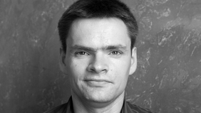
The special guest of the workshop was Dr Leif Isaksen, Senior Lecturer in History (Digital Humanities) and has a broad array of interests in the Digital Humanities, Web Science and Ancient Geography. He was formerly Associate Professor of Archaeology & Digital Humanities at the University of Southampton and codirected its Web Science Centre for Doctoral Training. He is an executive committee member of the European Association for the Digital Humanities (EADH) and Chairs the Publications Committee of the Alliance of Digital Humanities Organisations (ADHO). He is a former Trustee of the International Association for the History of the Map (ISHMap) and Chaired the NeDiMAH network’s Working Group on Space and Time in the Digital Humanities. He moderates two online networks for computing in the Humanities (Antiquist and The Networks Network). Dr Isaksen is a Director of the Pelagios initiative which uses Linked Open Data to connect online resources about the past. Earlier projects he has been involved with include Google Ancient Places which visualized places from antiquity in massive corpora; Hestia, which explored the geographic aspects of Herodotus’s Histories; Crossbones, a tool for the schematic visualization of in situ human and faunal remains; the RTIViewer for Reflectance Transformation Imaging; and the Virtual Lightbox for Museums and Archives (VLMA). He has degrees in Archaeology, Computer Science and Philosophy and worked for several years as a professional software developer.
Dr. Isaksen opened the workshop with an introductory lecture on advantages and disadvantages of Geographic Information Systems in the humanities research. The lecture was followed by the presentation of Polish digital projects which employ maps. Dr. Bartłomiej Szleszyński (IBL PAN) presented the „Atlas of Polish Romanticism”, a collection of New Panorama of Polish Literature; dr Artur Szklener (Director of the The Fryderyk Chopin Insitute) presented locative multimedia applications developed in his institution; Dr. Eng. Michał Marcińczuk (Wrocław University of Technology, CLARIN-PL) presented digital tools for indexing the spatial data from texts; Arkadiusz Borek, M.A. (Institute of History of the Polish Academy of Sciences) presented the historical project Atlas Fontium. Discussion was moderated by Dr. Maciej Maryl, Director of the Digital Humanities Centre at IBL PAN.
The last part of the workshop was dedicated to practical exercises. Dr. Isaksen presented the Pelagios project and Recogito, the tool for tagging and mapping places mentioned in ancient texts.
Illustration source: nplp.pl